Outdoors · Fall · September theme
High Falls State Park: choose the right trail for your day
Compare High Falls State Park’s Historic, Falls View and Tranquility trails by length, surface and difficulty before planning your day trip.
Part of our year-round planning collection. Month labels describe seasonal themes.
THE PLAN AT A GLANCE
High Falls has very different walking options. The short Historic Trail is the place to start for an easier route; Falls View is rated strenuous despite its modest distance.
Choose the route before packing the day
High Falls State Park is a useful option for a Middle Georgia outdoor day, but “see the waterfall” does not describe how much walking your group wants. Begin with the route, then decide whether to add a picnic or another stop.
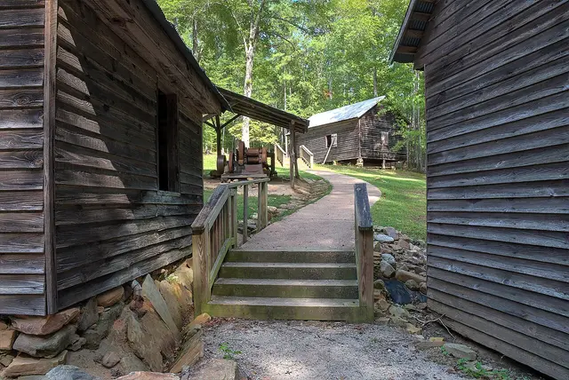
The official trail guide lists the Historic Trail as 0.5 miles, easy, with a crushed-gravel base and an ADA-accessible designation. Falls View is 1.5 miles, natural surface and strenuous. Tranquility is 2.5 miles, natural surface and moderate. These are the park’s classifications; conditions and your group’s needs still matter.
For a shorter outing: Historic Trail
Choose the Historic Trail when the point of the trip is to spend some time outdoors without committing to a longer hike. Use its published accessibility designation as a starting point for planning, then ask the park about current conditions and any specific equipment or mobility needs.
Our suggested plan is a short trail visit followed by a relaxed meal break. Leave the second half of the outing optional. A short route can work well when you have mixed walking speeds, visiting relatives or a limited window between other commitments. Do not assume a short distance means every surface will feel effortless to every visitor.
For a more demanding walk: Falls View
Falls View is the option to investigate when you want the walk itself to be a central part of the day. Its strenuous rating should influence your choice more than the 1.5-mile number. Ask everyone in the party whether a demanding natural-surface trail fits what they want from the outing.
Keep the plan simple: choose the trail, allow a flexible amount of time, and leave room to turn back. Taking photographs can stretch an outing beyond the walking time you had in mind. Avoid promising a precise finish time to someone waiting at your next stop.
For a longer woodland walk: Tranquility
Tranquility is worth comparing if your priority is time on a woodland route rather than the shortest way to a viewpoint. Check the park’s latest map before setting off. Pick this trail because its character and difficulty suit the group, not merely because it is the longest of the three.
If you are undecided between two trails, make one the main plan and the other an option. That avoids turning a pleasant outing into a task to complete. Check the forecast and park notices again on the day, and adjust the route if conditions no longer match what you planned.
Keep parking and extras separate in your budget
A ParkPass is required for vehicles according to the official trail information. Check the park page for current admission and parking arrangements; rentals and overnight stays are separate decisions. A day-use plan should not assume equipment or accommodation is available without checking.
For a group arriving in several cars, discuss transport before calculating the budget. Set food and optional spending aside from the cost of entering or parking. If you already have a pass, check that it applies to the visit you are planning rather than assuming all Georgia attractions use the same admission system.
Make the trip work from Middle Georgia
Use the map to place High Falls in relation to your starting point. Decide whether a second destination adds something worthwhile or only adds driving. A trail and a picnic can be a complete day without a list of extra stops.
Before departure, choose one meeting point, share the selected route and keep the official trail map available. If your group wants an easier alternative, choose it before reaching the trailhead. Planning around the least ambitious comfortable option is often what lets everyone enjoy the same outing.
PUT THE PLAN TOGETHER
Places & listings in this guide
Open a listing for its official source. Confirm hours, admission, access and event dates with the venue before travelling.
Common questions
Is the Falls View Trail an easy walk?
The park rates Falls View strenuous. Its 1.5-mile length should not be mistaken for an easy rating.
Which High Falls trail is listed as accessible?
The official guide describes the 0.5-mile Historic Trail as ADA accessible. Confirm current surface conditions and your specific access needs with the park.
CHECK THE DETAILS
Sources & planning notes
These official and specialist sources support the guide. Opening hours, ticket prices, access and schedules can change. Follow the original source before you leave; a seasonal idea does not confirm an event or activity is available on your dates.
Read how Try478 prepares its guides or send a correction or local tip.